Eire to Pittsburgh Trail, Foxburg to Parker

Trail Info:
Location: Foxburg, just beyond Allegheny Grill.
Difficulty: Easy
Trail Characteristics:
- 2.6 miles one way. (park a car at either end) or 5.2 miles out and back.
- Paved, flat trail, no inclines, no water on the trail.
- Parking on either end
- Labeled “Alleghany River Trail” on Google Maps.
Directions on PCs: Locate the Google map below the search box on the right-hand side of this webpage. Click “Get Directions” on the map pin details.
Directions on Tablets and Mobile Phones: Locate the Google map near the bottom of this page, just below the search box. Click “Get Directions” on the map pin details.
Trail Map:

Trail Photos:

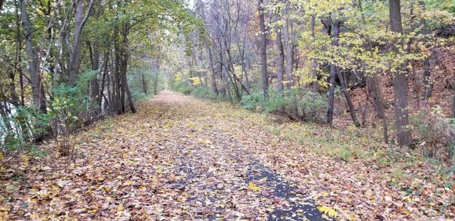
We chose to start on the Foxburg end of the trail segment and had pre-placed a second vehicle in Parker. This leg of the trail is 2.6 miles so a one-way trip just made sense for us.

The entire length of the trail follows the Alleghany River, with a bit of abandoned oil equipment strewn about on the riverside. The other side of the trail slopes upward at a steep angle, with only trees and rocks to look at most of the time.

I did manage to find some sort of foundation with a rounded interior up on the slope. Trees grew inside and on top of the walls, so it must have been abandoned for quite some time. If I had to guess, I’d think it was used to hold water, as there is a stream coming down the hill nearby.


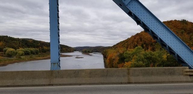
If you get to the bridge you are more than halfway, with 1.5 miles completed and just over a mile left. The Clarion river spills into the Alleghany River just after the bridge. There is a thin sliver of an island named “Clarion Island” in the center of the Alleghany River.

You are just about to Parker when you start seeing rock outcroppings covered with Moutain Laurel.


The end of the trail leads to a parking lot under the Parker bridge, but we decided to have a walk up to the bridge and get a good view of Parker.


Overall it’s a great trail in the fall to see some of the foliage change, and a flat trail is always nice when you are recovering from a steep one.


